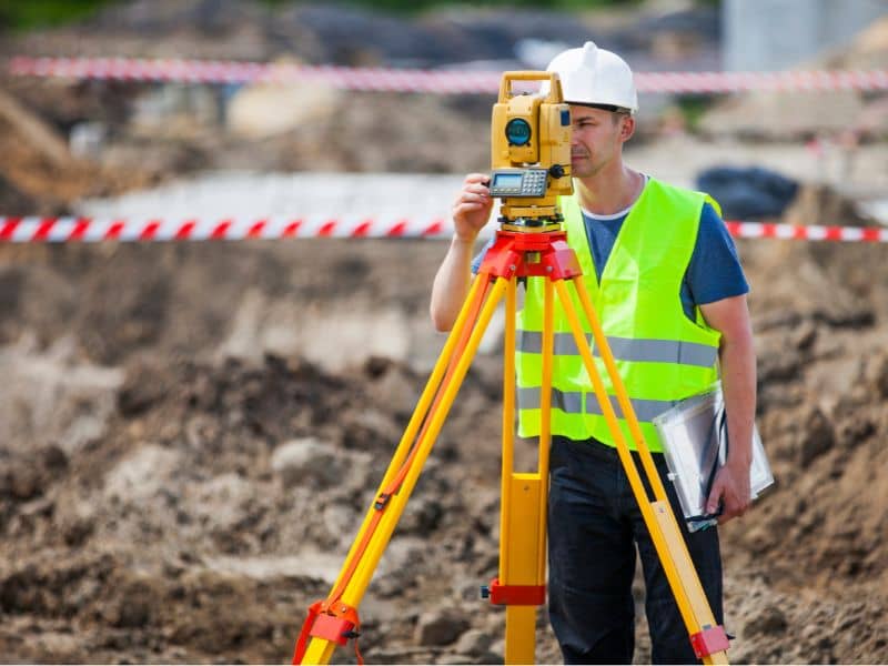
Welcome to Lafayette Land Surveying

Welcome to Lafayette Land Surveying’s website

This site is intended to provide you with information on a Land Surveying Company in Lafayette, AL. If you’re looking for a Lafayette Land Surveyor, you’ve come to the right site. If you’d rather talk to someone about your land surveying needs, please call (334) 234 9946 today. For more information, please continue to read. 

Lafayette land surveying

Land Surveyors are professionals who measure and make precise measurements to determine the size and boundaries of a piece of real estate.  While this is a simplistic definition, boundary surveying is one of the most common types of surveying related to home and land owners. If you fall into the following categories, please click on the appropriate link for more information on that subject:

Lafayette Land Surveying services:

  1. I need to know where my property corners or property lines are. (Boundary Survey)
  2. I have a loan closing or re-finance coming up on a commercial property or multi-family property and need an ALTA Survey. (ALTA Survey)
  3. I need a map of my property with contour lines to show elevation differences for my architect or engineer. (Topo Survey)
  4. I’ve just been told I’m in a flood zone or I ‘ve been told I need an elevation certificate in order to obtain flood insurance or prove I don’t need it. (Flood Survey)
  5. I’m purchasing a larger tract of land, acreage, that hasn’t been subdivided in the past. (Boundary Survey)

If your needs don’t fall into one of the above, don’t worry, we’ll get to the bottom of it. CALL Lafayette  Land Surveying TODAY at (334) 234 9946 OR better yet, fill out a Contact Form request to discuss your survey needs.

Learn The Basics of Boundary Surveying Lafayette

Investing in land or real property may be the most expensive investment you’ll make in your lifetime. Thus, it is wise to learn a little more about real estate and be aware of the significance of boundary surveying before making such investments.

Boundary Survey Defined

Let’s first define boundary surveying. Boundary surveying is the verification of property lines of a parcel of land as detailed in the description in the deed. It may also show all the structures found on the property including any easements and encroachments, and also the restrictions imposed by local governing authorities.

To avoid unnecessary expenses and free you from frustrations brought by unexpected lawsuits, it is vital to conduct a boundary survey in the Lafayette area before purchasing or selling a parcel of land. A survey is also required before subdividing a lot, building structures or improving the property to make sure that you don’t end up having to move a building or resolve a boundary dispute with your neighbors.

Other Uses of a Boundary Survey

A boundary survey may also help you identify whether you are located in a floodplain, which would mean you are required to obtain flood insurance. A boundary survey in Lafayette is also very helpful in completing the requirements for a mortgage loan from a lending institution, which includes checking the accuracy of the description of the property in the deed and the presence of improvements, easements, and any encroachments.

land surveyingBoundary Survey Costs

The cost of a Lafayette boundary survey depends on several factors, some of which can only be determined once the work has begun. Some factors are size of the lot, the terrain, the vegetation type, the season of the year (which greatly affects the growth of vegetation). The work begins with the deed research that can be started with the deeds or abstracts that the landowner may possess and can extend as much as going to the courthouse and putting together the pieces of the deed. The job could get more complex if the property involved has been passed on through several owners over the years. Some may have sold off a portion of the parcel or may have added to adjacent lots. The more of these additions and subtractions can significantly impact the complexity of the work to be done, which consequently adds to the survey cost.

Boundary Survey Drawing

After the boundary survey is done, a landowner should expect to get a survey drawing that contains a sketch of the survey findings and the legal description of the property. It is also expected that proper markings of the property lines and corners have been placed, which are usually bright-colored ribbons or paint, wooden stakes, or concrete monuments. Others survey projects may or may not include a drawing or report, depending on the services agreed upon.

What is an ALTA Title Survey?

ALTA stands for American Land Title Association. ALTA Land Surveys are similar to a boundary or lot survey of a piece of land. However, an ALTA Title Survey has further requirements for the land surveyor as he executes the survey because of the high-dollar value of the property.

ALTA Survey Standards Lead to Consistency

ALTA SurveyMost states have widely varying standards for surveying. Thus, ALTA Surveys follow a national standard for surveying aimed to generate consistency regardless of the location of the survey. This type land survey is usually done on a multi-family residential or commercial site and when the owner and/or lender are from different states. But more often than not, it is prepared for commercial properties because it provides the information needed in order to insure the title to the land. Commercial developments may also require improvements to a high level that is also obtained through this survey.

ALTA Title Surveys are very complex and are commonly more costly than surveys following state standards because it takes more time and effort.

Costs for such surveys could be up to 50% – 200% more than a similar boundary survey. It is also important to note that the more restrictive standard is followed in the survey if the state standard is more restrictive on a certain aspect than the ALTA standard. An ALTA Title Survey must show all data including boundary lines, main building location and all its improvements, location of ancillary buildings, rights-of-way, and easements or access rights by utility services such as water, telephone, als, railway and other utilities. A helpful tip in outlining the scope of services of the land surveyor is to thoroughly go over the elements of “Table A – Optional Survey Responsibilities and Specifications”.

ALTA Survey Requires Title Committment

Before an ALTA Title Survey can be completed, there must be a current title commitment. This is where the land surveyor will refer for the legal description of the property and all legal encumbrances or exceptions. The areas of ownership, encumbrances, and improvements will be presented graphically including encroachments, if there is any.

All the affected parties; the buyer, seller, lender, and title insurance company must be indicated on the ALTA Title Survey certificate. The land surveyor and the title insurance company must closely work together in order to illustrate comprehensively all matters affecting the ownership of the land and improvements.

Requirements for an ALTA/ACSM Land Title Survey as detailed by the American Land Title Association, National Society of Professional Surveyors and the American Congress on Surveying and Mapping is certainly met through an ALTA Title Survey.

If we can help you with an ALTA Title Survey in the future, please don’t hesitate to contact us at Lafayette Land Surveying at (334) 234 9946 or fill out our contact form by clicking the link.


The Basics of Land Surveying

land surveying

What is Land Surveying?

Land Surveying dates back to ancient history. Surveying is used for multiple projects.  A survey is done to establish a specific location of a parcel of land along with its exact acreage.  It is used to ascertain boundaries for defining an area of ownership and tax liability.  It is also used to identify a piece of property by a written legal description or to provide a review of the accuracy of an existing description. Data from land surveying is of the utmost importance with regard to buying and selling land, and is also used to insure a clean and marketable title.

Other types of Land Surveying

There are many different kinds of surveys that can be performed. Boundary surveying is typically done for undeveloped land. This type of land surveying measures the actual physical extent of the property in question. Most surveys progress through the basic procedures regardless of the type being done. Any pertinent deeds, contracts, maps or other documents that contain a description of the property’s boundaries are located, studied and interpreted. A determination is made of what the actual property description is deemed to be, along with the locations of any physical evidence of the boundaries. This can be in the form of both natural and man-made monuments or markers that exist in the field. The property is then measured to establish the boundaries, not only using the appropriate existing monuments but with the creation and referencing of new markers where necessary. Measurements are accomplished using a total station and other land surveying tools. A total station measures both vertical and horizontal angles, as used in triangulation networks. After these steps are accomplished, the property description and plat are prepared.

Results of land surveying

Interpreting the results of a land survey is not as difficult as it may first seem. For instance, a property plat will usually contain a directional orientation which is typically indicated with an arrow pointing north. It will contain the bearing and distance of each boundary line, the property lines of other properties shown on the plat, and the names of adjacent property owners listed in the areas of their property. Corner monuments, along with the names of any natural monuments (such as “Smith’s Creek”, for example) or a brief description of any unnamed natural monuments (such as the “30-inch pine tree”) are on the plat. There is also a title block containing the property’s location and name of owner, the surveyor’s name, the date the survey was performed, the scale of the plat and any other relevant data.

If you need the services of a surveyor for your land surveying needs, ALWAYS be sure that you’re hiring an experienced, certified, and highly competent professional surveyor. You can find out if the surveyor is licensed by visiting the Board of Licensure’s website.

Call Lafayette Land Surveying today at  (334) 234 9946  or fill out a contact form request for more information concerning your land surveying needs.

“Only Transact with a licensed land surveyor for your land surveying needs”